
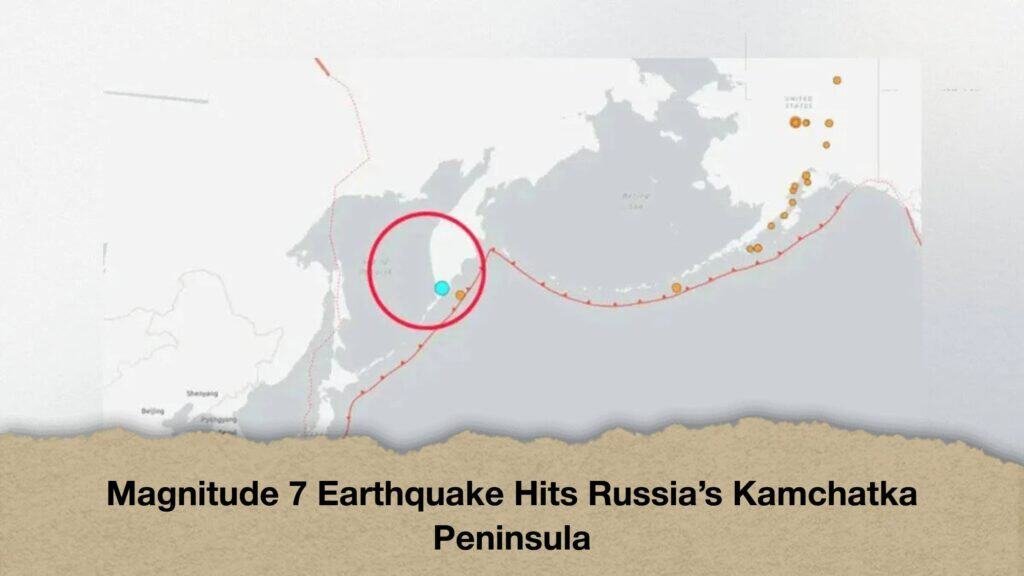
A powerful earthquake measuring 7.0 on the Richter scale struck Russia’s Kamchatka Peninsula, raising concerns about possible damage in the country’s Far East. The tremor occurred at around 3:35 pm local time. However, no tsunami warning was issued, and there were no immediate reports of casualties or damage.
According to the European-Mediterranean Seismological Centre (EMSC), the earthquake’s epicentre was approximately 123 kilometres south-west of Vilyuchinsk, a city in Russia’s Far East. The quake originated at a depth of around 140 kilometres beneath the Earth’s surface.
Following the tremor, authorities assessed the potential risk of a tsunami. The United States National Tsunami Warning Centre said the earthquake posed no tsunami threat, easing immediate concerns about possible tsunami-related dangers along the coast.
However, details about the earthquake’s impact on local communities, buildings, roads and other infrastructure were not immediately available. There were also no confirmed reports of casualties. Further information from the relevant authorities will be needed to establish the full extent of any damage.
Erroneous 9.9-magnitude alert causes confusion in Japan
The earthquake also drew attention to an erroneous early warning issued by the Japan Meteorological Agency (JMA).
According to BNO News, the agency mistakenly issued an advance alert indicating a potential earthquake measuring 9.9 in magnitude. The warning forecast intense shaking across a large part of Japan.
However, the agency’s own measurement put the earthquake’s magnitude at 6.9, significantly lower than the figure cited in the initial alert.
Had a magnitude 9.9 earthquake actually occurred, it would have exceeded the strongest earthquake ever recorded. However, the figure was part of an erroneous warning and did not represent the actual magnitude of the earthquake.
Earthquake early-warning systems play an important role in helping authorities and communities prepare for natural disasters. Initial estimates may differ from subsequent measurements as more data become available. This makes the timely verification and correction of alerts essential, particularly when warnings cover densely populated areas.
Why is Kamchatka prone to earthquakes?
The Kamchatka Peninsula lies within the Pacific Ring of Fire, a vast geological zone extending around much of the Pacific Ocean. The region experiences frequent earthquakes and volcanic activity because of the movement and interaction of tectonic plates.
Pressure gradually builds up along the boundaries of these plates. When the accumulated stress is suddenly released, seismic waves travel through the Earth, causing the ground to shake. Kamchatka’s active geological environment makes it one of the world’s most earthquake-prone regions.
In July last year, a powerful earthquake measuring 8.8 struck off the coast of the Kamchatka Peninsula. Tsunami warnings were issued across several areas of the Pacific, while parts of Russia’s coastal regions were affected. Reports said tsunami waves inundated parts of Severo-Kurilsk.
The latest earthquake has once again highlighted the region’s vulnerability to major seismic events. Although no tsunami threat was identified following this tremor, monitoring local conditions and assessing possible damage remain important.
The magnitude of an earthquake alone does not determine the extent of destruction. Its depth, distance from populated areas, local ground conditions and the strength of buildings and infrastructure all influence the level of damage.
Further information will be needed to determine the full impact of the latest earthquake on communities in Russia’s Far East.