Khabor Wala Desk
Published: 4th December 2025, 5:52 PM
Rangamati, a hilly district in Bangladesh, faces significant risk from major earthquakes. Historical records indicate that no major earthquake has struck the area in the past 500 to 1000 years, raising concerns of a future large-scale earthquake. Such an event could lead to substantial casualties and widespread structural damage.
The district is surrounded by hills, with limited flat land. Government offices, private institutions, and local residents have levelled parts of hills to construct buildings.
Sources report over 20,000 buildings across Rangamati, including government, private, and public properties. Most buildings do not comply with building codes, placing both the structures and their occupants at high risk in the event of a major earthquake.
According to meteorological maps and experts, parts of Rangamati and Khagrachhari are within Zone-1, the country’s most earthquake-prone areas. The district is near the Dauki Fault Line, which could trigger a major earthquake.
On 6 August 2003, Barkal Upazila near the Mizoram border experienced two moderate earthquakes at 6:30 am and 11:20 am, registering 5.6 on the Richter scale. The tremors lasted about four seconds and caused damage to several government, private, and school buildings, though no casualties were reported.
In January 2008, Barkal experienced 18 tremors from 13 to 30 January. Small tremors were also felt in Chattogram and nearby hill districts, but all 18 occurred in Barkal.
Bangladesh is divided into three earthquake zones, with hill districts designated as Zone-1. Repeated earthquakes caused cracks in many government buildings in Barkal, particularly in structures on hills. Between 2009 and 2016, small to moderate earthquakes occurred annually, with 24 in 2009 and 21 in 2010.
Geologists noted that the moderate earthquake on 13 January 2008 lasted 25–30 seconds and occurred three times in quick succession. Its epicentre was near the Bangladesh-India border, causing strong tremors in Rangamati, measuring 4.9 on the Richter scale.
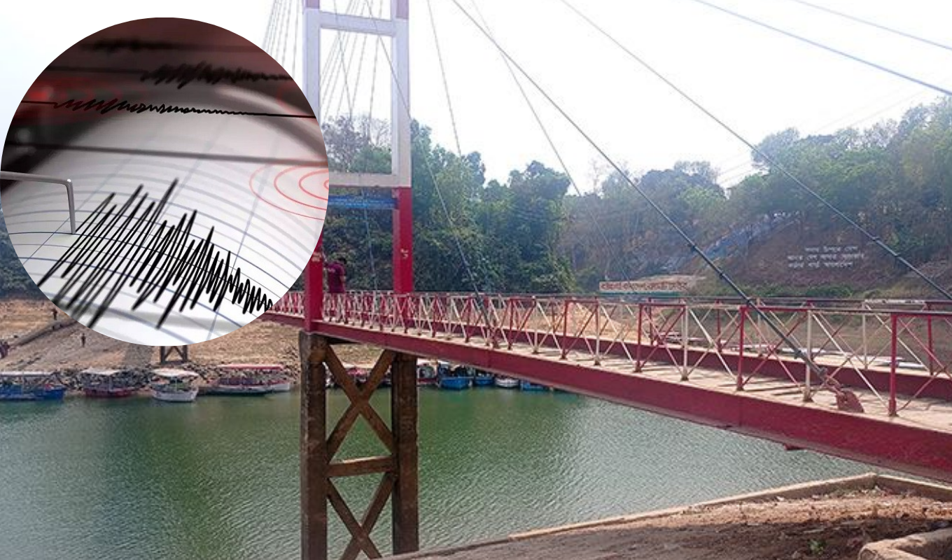
On 26 November 2021 at 5:45 am, a 6.2 magnitude earthquake was felt in Rangamati and other regions, lasting a few seconds. The epicentre was near Mizoram, India, close to Myanmar, causing cracks in the Purunbosti-Jhuluikya bridge and a mosque, and injuring three people, including two UNDP workers.
In 2024, Rangamati felt several earthquakes: 5.0 on 2 June from Mayawadi, Myanmar; 5.4 on 29 May across the country; 4.7 on 31 July from China’s Chin Province; and 4.9 on 1 December affecting Rangamati, Cox’s Bazar, and Chattogram, according to EMSC, with the epicentre in Myanmar.
Anwar Al Haque, president of Rangamati Press Club, stressed the need to construct buildings according to codes and raise awareness about earthquake preparedness.
Urban planner Subarna Chakma noted that in 2008, high-risk buildings such as Rangamati Sadar Hospital and Fire Service were identified, but no follow-up meetings occurred. Under new regulations, a 15-member committee led by the municipal mayor or administrator approves building permits, with maximum six-storey structures of 70–75 feet allowed. Taller buildings require district approval.
Md. Mobarak Hossain, Deputy Director of Local Government and Rangamati Municipality Administrator, said that awareness campaigns and guidance on earthquake safety are ongoing.
Dr. Badrul Imam, Dean of Earth and Environmental Sciences at Dhaka University, stated that earthquakes cannot be predicted or prevented, but damage can be reduced with proper planning. He added that the hilly districts are highly susceptible, and minor tremors may indicate potential larger quakes.
On 21 November 2024 at 10:38 am, a 5.7 magnitude earthquake affected Dhaka and other regions, causing building cracks and 10 fatalities. Minor tremors were also felt on 22, 23, 26 November, and 4 December.
Glive24/SS


Comments