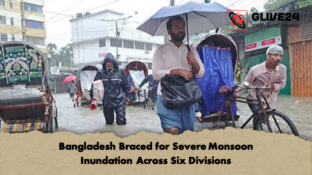
The Bangladesh Meteorological Department has triggered a nationwide alert, warning of imminent heavy to very heavy rainfall across six of the country’s main administrative divisions. The prolonged spell of active monsoon downpours is expected to bring substantial precipitation, elevating the threat of flash floods and severe waterlogging. Authorities have advised citizens in low-lying and riverine zones to monitor rising water channels closely over the coming week.
According to a formal advisory issued on Saturday, 11 July, under the signature of senior meteorologist Dr Mohammad Omar Faruq, an intense atmospheric depression will maintain volatile weather patterns across the country. The state weather bureau indicates that the current meteorological setup is primed to deliver persistent, thunderous downpours through multiple regional territories.
Phase One: Immediate Regional Impact
During the initial forecast window, which remains active until Sunday evening, 12 July, widespread light to moderate thunder-showers will be accompanied by sudden, gusty winds. These conditions are expected to impact the vast majority of the Rangpur, Rajshahi, Mymensingh, Dhaka, Khulna, Barisal, Chittagong, and Sylhet divisions.
The peak intensity of the monsoon will be felt in specific high-risk pockets. The meteorological office has singled out the following areas for potential flash flooding caused by torrential downpours:
-
Rangpur & Rajshahi: Braced for immediate structural drainage strain.
-
Mymensingh & Sylhet: Vulnerable to rapid river rises due to upper catchment runoff.
-
Dhaka & Chittagong: At extreme risk of urban waterlogging and disrupted transport networks.
Day and night temperatures are expected to show little variation during this opening phase. This steady, saturated atmospheric profile will extend straight into the next 24-hour cycle, running from Sunday evening through to Monday, 13 July. During this timeframe, the risk of extreme, very heavy rainfall will remain focused over the northern and north-eastern frontiers, meaning emergency services in Rangpur, Mymensingh, Chittagong, and Sylhet must remain on standby.
Phase Two: Westward Shift and Extended Outlook
A distinct realignment of the weather system is anticipated from Monday evening, 13 July. Over the subsequent 24 hours, the primary belt of rain will continue to cover most areas within the Rangpur, Rajshahi, Mymensingh, Dhaka, Khulna, and Sylhet divisions, while coastal districts in Chittagong and Barisal will see more scattered, intermittent downpours. Crucially, the focus of the heaviest rainfall will shift toward the western and northern farmlands, specifically threatening parts of the Rangpur, Rajshahi, Mymensingh, and Khulna divisions with potential crop inundation.
By mid-week, starting Tuesday evening, 14 July, the monsoon system may lose a fraction of its extreme intensity, though rain will remain highly widespread. Worshippers and commuters across all eight administrative divisions should anticipate light to moderate thunder-showers, with isolated areas experiencing moderate to heavy rainfall. While evening temperatures will remain unchanged, daytime temperatures are projected to edge upward slightly.
This wet spell shows no signs of a rapid conclusion. From Wednesday evening, 15 July, onward, unstable weather patterns will continue to dictate daily life, keeping the threat of localized urban flooding high. Looking further ahead, the Bangladesh Meteorological Department closed its bulletin by confirming that active monsoon currents will dominate the region well beyond the next five days, ensuring that disaster management authorities face a sustained challenge in monitoring fragile river basins.